Ang Mo Kio
| Ang Mo Kio | ||||||||||
|---|---|---|---|---|---|---|---|---|---|---|
| Planning Area and HDB Town | ||||||||||
| Other transcription(s) | ||||||||||
| • Chinese | 宏茂桥 | |||||||||
| • Pinyin | Hóng mào qiáo | |||||||||
| • Malay | Ang Mo Kio | |||||||||
| • Tamil | ஆங் மோ கியோ | |||||||||
| • Tamil romanisation | Āṅ mō kiyō | |||||||||
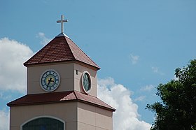
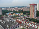
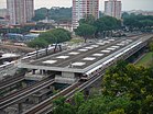
From top left to right: Clock tower of Presbyterian High School, Flats along Ang Mo Kio Street 53, Aerial view of Ang Mo Kio, Ang Mo Kio Street 52, Ang Mo Kio MRT Station, Ang Mo Kio Town Centre, Ang Mo Kio Avenue 5, Nanyang Polytechnic
|
||||||||||
| Location of Ang Mo Kio within Singapore | ||||||||||
| Coordinates: 1°22′12.6″N 103°50′44.23″E / 1.370167°N 103.8456194°E | ||||||||||
| Country |
|
|||||||||
| Region |
|
|||||||||
| CDCs | ||||||||||
| Town councils |
|
|||||||||
| Constituencies | ||||||||||
| Town announced |
|
|||||||||
| Town completed |
|
|||||||||
| DGP exhibited |
|
|||||||||
| PA incorporated |
|
|||||||||
| Government | ||||||||||
| • Mayors |
Central Singapore CDC North West CDC |
|||||||||
| • Members of Parliament |
Ang Mo Kio GRC Nee Soon GRC |
|||||||||
| Area | ||||||||||
| • Total | 13.94 km2 (5.38 sq mi) | |||||||||
| Area rank | 18th | |||||||||
| • Residential | 2.83 km2 (1.09 sq mi) | |||||||||
| Population (2015) | ||||||||||
| • Total | 174,770 | |||||||||
| • Rank | 8th | |||||||||
| • Density | 12,538.2/km2 (32,474/sq mi) | |||||||||
| • Density rank | 10th | |||||||||
| Demonym(s) |
Official
Colloquial
|
|||||||||
| Ethnic groups | ||||||||||
| • Chinese | 143,290 | |||||||||
| • Malays | 13,060 | |||||||||
| • Indians | 14,150 | |||||||||
| • Others | 4,270 | |||||||||
| Postal district | 20 | |||||||||
| Dwelling units | 49,169 | |||||||||
| Projected ultimate | 58,000 | |||||||||
Central Singapore CDC
North West CDC
Ang Mo Kio GRC
Nee Soon GRC
Official
Colloquial
Ang Mo Kio /ɑːŋ moʊ kɪoʊ/ (Chinese: 宏茂桥, Tamil: ஆங் மோ கியோ), often abbreviated as AMK, is a planning area and residential town situated in the North-East Region of Singapore. Ang Mo Kio is the 3rd most populated planning area in the North-East Region and ranks 8th in terms of population in the country overall. The planning area is located at the south-western corner of the North-East Region, bordered by the planning areas of Yishun to the north, Sengkang to the north-east, Serangoon to the east, Bishan to the south and the Central Water Catchment to the west.
Prior to urbanization, the area, much like other rural districts in Singapore at the time, was largely undeveloped, being mainly used for agricultural purposes, with uninhabited plots of land usually covered in dense secondary forest or swamps. Ang Mo Kio was subsequently redeveloped by the Housing and Development Board in 1973 as their seventh satellite town and the first to be built in metric dimensions, being fully completed by 1980. The first three town councils in the country were established in Ang Mo Kio in 1986, as part of a pilot project to better serve residents of HDB new towns. The concept eventually became adopted under the Town Council Act of 1988 which today, remains as the second-level of administration in Singapore.
...
Wikipedia


