Bahía de los Ángeles
| Bahía de los Ángeles | |
|---|---|

From top down: Panorama of the Bahia, Punta Areanas Lighthouse, Harbor View, Sail Sculpture, Dolphins, Sunrise over Cabeza de Caballo, Museo de Naturaleza y Cultura, Sunset behind Sierra de San Borja
|
|
| Nickname(s): Bay of L.A., L.A. Bay | |
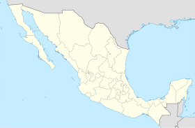
| Location in Mexico | |
| Coordinates: 28°56′53″N 113°33′37.44″W / 28.94806°N 113.5604000°W | |
| Country |
|
| State |
|
| Municipality | Ensenada |
| Established (Spain) | 1746 |
| Elevation | 26 ft (8 m) |
| Population (2010) | |
| • City | 800 |
| • Urban | 590 |
| Time zone | Northwest (US PST) (UTC-8) |
| • Summer (DST) | Northwest (UTC-7) |
| Website | http://www.bahiadelosangeles.info/ |
Bahía de los Ángeles ("Bay of the Angels") is a coastal bay on the Gulf of California, located along the eastern shore of the Baja California Peninsula in the state of Baja California, Mexico. The town of the same name is located at the east end of Federal Highway 12 about 42 miles (68 km) from the Parador Punta Prieta junction on Federal Highway 1. The area is part of the Ensenada Municipality.
The area was known as Adac to the Cochimí people, the aboriginal inhabitants of the central part of the Baja California peninsula. In the early 1600s there were approximately 3000 Cochimi inhabiting the area.
In 1539 Francisco de Ulloa was the first European to discover the Bay in what was the final expedition financed by Hernán Cortés. The area known then as the Bahía de Lobos (Bay of Sea Lions) was explored again in 1746 by the Jesuit missionary Fernando Consag during his attempt to investigate the disputed question involving the Island of California. Consag is credited with giving the area its current name. In 1752 a loading dock was built to explore Mission San Borja, and the entire Baja California Peninsula.
After the departure of the Jesuits from the Baja Missions, the surrounding settlements, known at the time as visitas ("visiting chapels"), were gradually taken over by the locals, Bahia being one of them. By 1880 the interest in precious metals had spread to the Bahia region. In 1900 another loading dock was built to export gold and silver obtained from the mines of Sierra San Borja, San Juan, and Santa Martha. The San Juan silver mine at Las Flores became the largest producing mine in all of Baja. The mine was connected to the Bahia by an eight-mile narrow-gauge railroad allowing the ore to be transferred to the port there. The value of the silver produced by the mine was estimated (in 2002) to be 2 million U.S. dollars.
...
Wikipedia

