Bang Kapi
|
Bang Kapi บางกะปิ |
|
|---|---|
| Khet | |

Inside The Mall Bangkapi
|
|
 Khet location in Bangkok |
|
| Location in Thailand | |
| Coordinates: 13°45′57″N 100°38′52″E / 13.76583°N 100.64778°ECoordinates: 13°45′57″N 100°38′52″E / 13.76583°N 100.64778°E | |
| Country | Thailand |
| Province | Bangkok |
| Seat | Khlong Chan |
| Khwaeng | 2 |
| Area | |
| • Total | 28.523 km2 (11.013 sq mi) |
| Population (2016) | |
| • Total | 148,392 |
| • Density | 5,202.53/km2 (13,474.5/sq mi) |
| Time zone | ICT (UTC+7) |
| Postal code | 10240 except Moo Ban Seri: 10250 |
| Geocode | 1006 |
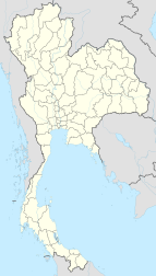
Bang Kapi (Thai: บางกะปิ, pronounced [bāːŋ kāpìʔ]) is one of the 50 districts (khet) of Bangkok, Thailand. It is bounded by other Bangkok districts (from north clockwise): Bueng Kum, Saphan Sung, Prawet, Suan Luang, Huai Khwang, Wang Thonglang, and Lat Phrao.
The area of Bang Kapi has a history dating back to Rama III's reign when Chao Phraya Bodindecha (เจ้าพระยาบดินทรเดชา) led a troop to fight rebels in Champassack and Louangphabang and brought back people to settle there.
When it had grown in size, Bang Kapi was established as an amphoe of Phra Nakhon Province. It was once very large, but has been split many times to form new amphoe and districts.
In 1966, the Huay Khwang sub-district and parts of the Bang Kapi sub-district were spun off to form Phaya Thai District.
In 1972, Phra Nakhon and Thonburi were joined as the single province Krung Thep Maha Nakhon. Administrative districts in the capital city were changed from amphoe and tambon to districts (khet) and sub-district (khwaeng), respectively. Bang Kapi thus became a district of the newly combined province, having at that time nine sub-districts.
...
Wikipedia

