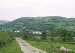
Betws, Carmarthenshire
Betws
|
|
|---|---|
 |
|
| Betws shown within Carmarthenshire | |
| Population | 2,175 |
| OS grid reference | SN633116 |
| Community |
|
| Principal area | |
| Ceremonial county | |
| Country | Wales |
| Sovereign state | United Kingdom |
| Post town | AMMANFORD |
| Postcode district | SA18 |
| Dialling code | 01269 |
| Police | Dyfed-Powys |
| Fire | Mid and West Wales |
| Ambulance | Welsh |
| EU Parliament | Wales |
| UK Parliament | |
| Welsh Assembly | |
Betws /ˈbɛtuːs/ is a small village on the River Amman, some 15 miles north of Swansea, Wales; it is part of the ecclesiastical parish of Betws and Ammanford. The nearby mountain, at the western end of the Black Mountain, is named after the village, and has a large area of common land.
The name 'Betws' is generally thought to be derived from the Anglo-Saxon 'bed-hus' - a house of prayer, or oratory, and means "chapel" in the Welsh language. Until the 19th century, when Ammanford developed extensively, Betws was the largest village in the area.
Until the 13th century, Betws was part of Gower, which is now known as the county of Swansea but the old commote border of the rivers Amman and Loughor moved south and Betws has since the Acts of Union been part of Welsh-speaking Carmarthenshire.
Until 1817, when a road was built along the Amman valley, Betws was only accessible by roads crossing the mountain from Neath and Swansea. This inaccessibility is commemorated in a local saying, which refers to the division between Betws a'r Byd (Betws and the world). There was a sign on the Amman bridge to this effect: Betws this way, the rest of the world that way.
...
Wikipedia

