Bokeo Province
|
Bokeo ບໍ່ແກ້ວ |
|
|---|---|
| Province | |
 |
|
 Map of Bokeo Province |
|
 Location of Bokeo Province in Laos |
|
| Coordinates: 20°18′00″N 100°25′01″E / 20.3°N 100.417°ECoordinates: 20°18′00″N 100°25′01″E / 20.3°N 100.417°E | |
| Country |
|
| Capital | Ban Houayxay |
| Area | |
| • Total | 6,196 km2 (2,392 sq mi) |
| Population (2015 census) | |
| • Total | 179,243 |
| • Density | 29/km2 (75/sq mi) |
| Time zone | UTC+07 |
| ISO 3166 code | LA-BK |
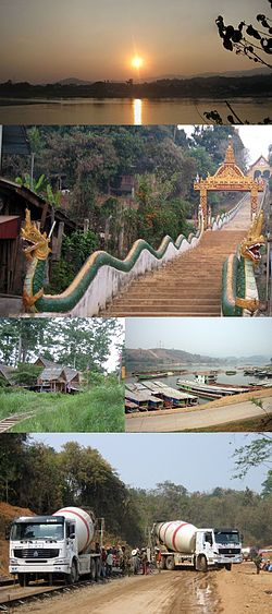
Bokèo (Laotian: ບໍ່ແກ້ວ [bɔ̄ː kɛ̂ːw]; literally "gem mine"; previously, Hua Khong, meaning "Head of the Mekong") is a northern province of Laos. It is the smallest and least populous province in the country. Bokeo Province covers an area of 6,196 square kilometres (2,392 sq mi). Bokeo Province borders Luang Namtha Province to the northeast, Oudomxai Province to the east, Xaignabouli Province to the south, and Thailand to the southwest and Burma to the west and northwest. The province has five districts (Houay Xay, Tonpheung, Meung, Phaodom and Paktha) and is rich in deposits of precious and semiprecious stones. Bokeo's provincial capital is Houayxay on the Mekong river. The province is part of the “Golden Triangle”, at the crossing with Myanmar and Thailand. There are 34 ethnic groups in the province. Houay Xay is the border town with Thailand and regional economic centre.
Bokeo ("gem mine") was named after the sapphires mined in Houay Xay District. A stele that is dated to 1458 is located within the Wat Jom Kao Manilat, a pagoda built in 1880 in teak wood in Shan architectural style. Fort Carnot is another historical monument of the French colonial period, which is now with the Lao army.
...
Wikipedia
