Dolores County, Colorado
| Dolores County, Colorado | ||
|---|---|---|

Dolores County Courthouse
|
||
|
||
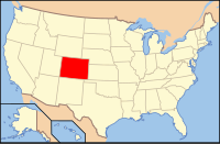
 Location in the U.S. state of Colorado |
||
 Colorado's location in the U.S. |
||
| Founded | February 19, 1881 | |
| Named for | Dolores River | |
| Seat | Dove Creek | |
| Largest town | Dove Creek | |
| Area | ||
| • Total | 1,068 sq mi (2,766 km2) | |
| • Land | 1,067 sq mi (2,764 km2) | |
| • Water | 1.0 sq mi (3 km2), 0.1% | |
| Population (est.) | ||
| • (2015) | 1,978 | |
| • Density | 1.9/sq mi (1/km²) | |
| Congressional district | 3rd | |
| Time zone | Mountain: UTC-7/-6 | |
| Website | www |
|
Dolores County is the seventh-least populous of the 64 counties of the U.S. state of Colorado. As of the 2010 census, the population was 2,064. The county seat is Dove Creek.
It is thought that the area has been the site of human habitation since at least 2500 B.C. Dolores County's western portions were densely populated between 900 and 1300 AD. Population estimates of as many as 10,000 population, with villages of hundreds of rooms, have been made by archaeologists and other researchers. But this population was destroyed or migrated elsewhere, apparently following a drought and severe societal upheaval in the 14th century, and for centuries thereafter, both the western and eastern mountainous areas of the county were occupied mostly by nomads, including the Ute and the Navajo Indians. Like much of southwestern Colorado, Dolores County is rich in Indian ruins and sites of the Anasazi. According to the Anasazi Heritage Center, Dolores County contains at least 816 recorded archaeological sites as of 1989, with many more inventoried since that time.
The county also contains a portion of a site of regional historic interest, the Dominguez-Escalante Trail of 1776. The trail marks a historic 1,800-mile (2,900 km) trip, intended to discover an overland route between Santa Fe, New Mexico and Monterey, California. The Expedition camped on Dove Creek in the western portion of the county. The Old Spanish Trail later passed through the western portion of the County.
Anglo trappers worked the mountains of eastern Dolores County as early as 1832-33, and gold was discovered in the County in 1866. But it was not until the area was taken from the Ute and removed from the Ute Reservation by the Brunot Agreement of 1878 that large-scale minerals exploration and mining began in the county, although the Pioneer Mining District was established (illegally) in 1876 in the Rico area. The development of the area was spurred by the discovery of large silver deposits near Rico in 1879, and the Rio Grande Southern Railroad was constructed through the County to connect Durango, Telluride, and Ridgway in 1890-92 The RGS served the eastern end of Dolores County until 1952 when it was abandoned. (The western portion of the county has never had railroad service.)
...
Wikipedia

