Down County Council
| Down District | |
|---|---|
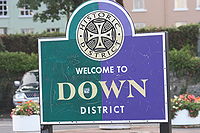
 Sign bearing Down District Council logo |
|
 |
|
| Area | 647 km2 (250 sq mi) Ranked 7th of 26 |
| District HQ | Downpatrick |
| Catholic | 62.5% |
| Protestant | 32.1% |
| Country | Northern Ireland |
| Sovereign state | United Kingdom |
| EU Parliament | Northern Ireland |
| Councillors |
|
| Website | www |
Coordinates: 54°21′07″N 5°43′52″W / 54.352°N 5.731°W
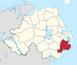
Down District Council was a Local Council in County Down in Northern Ireland. It merged with Newry and Mourne District Council in April 2015 under local government reorganisation in Northern Ireland to become Newry, Mourne and Down District Council.
The Council was headquartered in Downpatrick. Other towns in the Council area were Ardglass, Ballynahinch, Castlewellan, Clough, Crossgar, Dundrum, Killough, Killyleagh, Newcastle, Saintfield, Seaforde and Strangford.
The Down District Council area consisted of 4 electoral areas: Ballynahinch, Downpatrick, Newcastle and Rowallane. At the last election in 2011, 23 Councillors were elected from the following political parties: 9 SDLP, 5 Sinn Féin, 3 DUP, 3 UUP, 1 Alliance Party, 1 Green Party, 1 Independent. The Council Chairman for the 2011/2012 council term was Councillor Dermot Curran (SDLP) and the Vice Chair is Councillor Liam Johnston (Sinn Féin).
...
Wikipedia
