Fort Pierre, South Dakota
| Fort Pierre, South Dakota | |
|---|---|
| City | |

United Church of Christ Congregational in Fort Pierre
|
|
| Motto: "Where The West Begins" | |
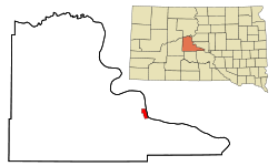
 Location in Stanley County and the state of South Dakota |
|
| Coordinates: 44°21′32″N 100°22′33″W / 44.35889°N 100.37583°WCoordinates: 44°21′32″N 100°22′33″W / 44.35889°N 100.37583°W | |
| Country | United States |
| State | South Dakota |
| County | Stanley |
| Incorporated | 1890 |
| Area | |
| • Total | 3.16 sq mi (8.18 km2) |
| • Land | 3.11 sq mi (8.05 km2) |
| • Water | 0.05 sq mi (0.13 km2) |
| Elevation | 1,434 ft (437 m) |
| Population (2010) | |
| • Total | 2,078 |
| • Estimate (2015) | 2,117 |
| • Density | 668.2/sq mi (258.0/km2) |
| Time zone | Mountain (MST) (UTC-7) |
| • Summer (DST) | MDT (UTC-6) |
| ZIP code | 57532 |
| Area code(s) | 605 |
| FIPS code | 46-22260 |
| GNIS feature ID | 1255113 |
| Website | http://www.fortpierre.com/ |
Fort Pierre is a city in Stanley County, South Dakota, United States. It is part of the Pierre, South Dakota Micropolitan Statistical Area and the county seat of Stanley County. The population was 2,078 at the 2010 census. Lily Park in Fort Pierre is situated at the confluence of the Bad and Missouri rivers.
On March 30, 1743, Francois and Louis-Joseph Gaultier de La Vérendrye reached the area of present-day Fort Pierre during their expedition west from Quebec. They left a metal plate buried in a hill to mark their journey and claim the land for France. The Lewis and Clark Corps of Discovery Expedition met with the Teton Sioux on the south side of the mouth of the Bad River on 24–28 September 1804. Fort Pierre Chouteau was established in 1832 as a trading post and fort by St Louis industrial fur trader Pierre Chouteau, Jr. on the north side of the river's mouth to replace Fort Tecumseh, established 1817 and a mile to the north on what is now LaFramboise Island.
Fort Pierre celebrates its Bicentennial in 2017, marking 200 years of continuous settlement at the confluence of the Missouri and Bad Rivers.
Fort Pierre is located at 44°21′32″N 100°22′33″W / 44.35889°N 100.37583°W (44.358941, -100.375742).
...
Wikipedia
