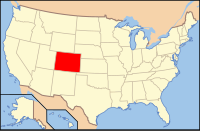
Gunnison County, Colorado
| Gunnison County, Colorado | |
|---|---|
 Location in the U.S. state of Colorado |
|
 Colorado's location in the U.S. |
|
| Founded | March 9, 1877 |
| Named for | John W. Gunnison |
| Seat | Gunnison |
| Largest city | Gunnison |
| Area | |
| • Total | 3,260 sq mi (8,443 km2) |
| • Land | 3,239 sq mi (8,389 km2) |
| • Water | 21 sq mi (54 km2), 0.6% |
| Population (est.) | |
| • (2015) | 16,067 |
| • Density | 4.7/sq mi (2/km²) |
| Congressional district | 3rd |
| Time zone | Mountain: UTC-7/-6 |
| Website | www |
Gunnison County is the fifth-most extensive of the 64 counties in the U.S. state of Colorado. As of the 2010 census, the population was 15,324. The county seat is Gunnison. The county was named for John W. Gunnison, a United States Army officer and captain in the Army Topographical Engineers, who surveyed for the transcontinental railroad in 1853.
Daniel I.J. Thornton, the Republican governor of Colorado from 1951 to 1955, operated a ranch in Gunnison County. The city of Thornton, Colorado, north of Denver, is named in his honor.
Archeological studies have dated the Ute people's appearance in the Uncompahgre region of Colorado as early as 1150 A.D. Possibilities exist that they are descendants of an earlier people living in the area as far back as 1500 B.C. They were a nomadic race of dark skin moving about the Western Slope of Colorado in the various parts of the year. In the early to mid-1600s the Spaniards of New Mexico introduced the horse which changed their patterns of hunting taking them across the divide to the eastern slopes and into conflict with the Plains Indians which soon became their bitter enemies.
The first recorded expedition of Western Colorado wilderness was led by Don Juan Rivera in 1765. In 1776, two Spanish priests, Fathers Escalante and Dominguez, led a party into the area around Montrose and Paonia.
...
Wikipedia
