Houten
| Houten | |||
|---|---|---|---|
| Municipality | |||

Town hall and station in Houten
|
|||
|
|||
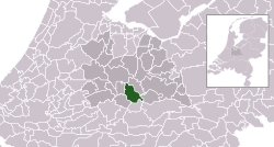
 Location in Utrecht |
|||
| Coordinates: 52°2′N 5°10′E / 52.033°N 5.167°ECoordinates: 52°2′N 5°10′E / 52.033°N 5.167°E | |||
| Country | Netherlands | ||
| Province | Utrecht | ||
| Government | |||
| • Body | Municipal council | ||
| • Mayor | Wouter de Jong (CU) | ||
| Area | |||
| • Total | 58.99 km2 (22.78 sq mi) | ||
| • Land | 55.41 km2 (21.39 sq mi) | ||
| • Water | 3.58 km2 (1.38 sq mi) | ||
| Elevation | 2 m (7 ft) | ||
| Population (May 2014) | |||
| • Total | 48,471 | ||
| • Density | 875/km2 (2,270/sq mi) | ||
| Time zone | CET (UTC+1) | ||
| • Summer (DST) | CEST (UTC+2) | ||
| Postcode | 3990–3999 | ||
| Area code | 030 | ||
| Website | www |
||
Houten [ˈɦɔutə(n)] (![]() pronunciation ) is a municipality in the Netherlands, in the province of Utrecht.
pronunciation ) is a municipality in the Netherlands, in the province of Utrecht.
The municipality consists of the following towns:
The main town in the municipality is Houten, a commuter town about 9 km southeast of Utrecht. On 1 January 2012, the town had 48,314 (CBS) inhabitants. The built-up area was 5.08 km2 (1.96 sq mi) in area, and contained 18,451 residences. The slightly larger statistical district of Houten had a population of about 39,100 in 2004.
Remains of a Roman villa have been found in the old centre of Houten, made visible in a street pattern. There used to be a Roman villa on that spot. This building was discovered in the fifties. In the Dark Ages Houten took shape as a rural centre. The area of the municipality of Houten was divided in the so-called 'gerechten' (districts). The names of these districts are still in use: Schonauwen, Wulven, Waijen, Heemstede.
A lot of elements in present-day Houten are reminders of its history. Prominent in the old centre 'Het Oude Dorp' are the Roman Catholic Church (1884) and the Protestant Church (1563). The first accounts of this church date from the ninth century, the oldest parts of the church are probably from the eleventh century. Another prominent building is the restaurant/cafe 'De Engel', already mentioned in the 16th century as a tavern.
Former access roads to the old centre are still recognisable by their names, such as the 'Odijkseweg' and 'Loerikseweg'. Houten had many orchards, but few have survived.
Modern Houten started to take shape in the last decades of the 20th century (1966–1998). It was first designated by the office of Wissing-Derks as a 'Groeikern' – a centre of growth – to meet the needs of the growing city of Utrecht. From the beginning urban planner-designer Robert Derks was involved with the development of the New Town Houten. In 1979 the construction of 10,000 dwellings started and the population grew from 4,000 to more than 30,000 late in the nineties.
...
Wikipedia


