Jefferson County, Missouri
| Jefferson County, Missouri | ||
|---|---|---|

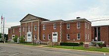
County courthouse in Hillsboro
|
||
|
||
 Location in the U.S. state of Missouri |
||
 Missouri's location in the U.S. |
||
| Founded | 1818 | |
| Named for | Thomas Jefferson | |
| Seat | Hillsboro | |
| Largest city | Arnold | |
| Area | ||
| • Total | 664 sq mi (1,720 km2) | |
| • Land | 657 sq mi (1,702 km2) | |
| • Water | 7.7 sq mi (20 km2), 1.2% | |
| Population (est.) | ||
| • (2015) | 224,124 | |
| • Density | 333/sq mi (129/km²) | |
| Congressional districts | 2nd, 3rd, 8th | |
| Time zone | Central: UTC-6/-5 | |
| Website | www |
|
| Jefferson County, Missouri | ||||
|---|---|---|---|---|
| Elected countywide officials | ||||
| Assessor | Terry Roesch | Democratic | ||
| Circuit Clerk | Michael Reuter | Republican | ||
| County Clerk | Wes Wagner | Democratic | ||
| Collector | Beth Mahn | Democratic | ||
|
Commissioner (Presiding) |
Ken Waller | Republican | ||
| Prosecuting Attorney | Forrest Wegge | Democratic | ||
| Public Administrator | Steve Farmer | Republican | ||
| Recorder | Debbie Dunnegan | Republican | ||
| Sheriff | Oliver Glenn Boyer | Democratic | ||
| Treasurer | Linda Nees | Democratic | ||
Jefferson County is a county in the eastern portion of the state of Missouri. As of the 2010 census, the population was 218,733, making it the sixth-most populous county in Missouri. Its county seat is Hillsboro. The county was organized in 1818 and named in honor of former president Thomas Jefferson.
In 1980, according to the U.S. census held that year, the county contained the mean center of U.S. population. Notably, this was the first census in which the center of population was west of the Mississippi River.
Jefferson County is part of the St. Louis Metropolitan Statistical Area and encompasses many of the city's southern suburbs.
According to the U.S. Census Bureau, the county has a total area of 664 square miles (1,720 km2), of which 657 square miles (1,700 km2) is land and 7.7 square miles (20 km2) (1.2%) is water. The county's eastern border is the Mississippi River and on the other side is Illinois.
Much of Jefferson County is in the projected totality path of the solar eclipse of August 21, 2017.
As of the 2010 Census Jefferson County had a population of 218,733. The reported ethnic and racial make up of the population was 95.4% non-Hispanic white, 0.8% African-American, 0.3% Native American, 0.6% Asian, 0.4% reporting some other race, 1.3% reporting two or more races and 1.6% Hispanic or Latino of any race.
As of the census of 2000, there were 198,099 people, 71,499 households, and 54,553 families residing in the county. The population density was 302 inhabitants per square mile (117/km2). There were 75,586 housing units at an average density of 115 per square mile (44/km²). The racial makeup of the county was 97.48% White, 0.08% Black or African American, 0.29% Native American, 0.36% Asian, 0.01% Pacific Islander, 0.24% from other races, and 0.93% from two or more races. Approximately 1.01% of the population were Hispanic or Latino of any race.
...
Wikipedia

