Johnson County, Arkansas
| Johnson County, Arkansas | |
|---|---|

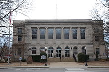
Courthouse in Clarksville
|
|
 Location in the U.S. state of Arkansas |
|
 Arkansas's location in the U.S. |
|
| Founded | November 16, 1833 |
| Seat | Clarksville |
| Area | |
| • Total | 683 sq mi (1,769 km2) |
| • Land | 660 sq mi (1,709 km2) |
| • Water | 23 sq mi (60 km2), 3.4% |
| Population (est.) | |
| • (2015) | 26,141 |
| • Density | 39/sq mi (15/km²) |
| Congressional district | 4th |
| Time zone | Central: UTC-6/-5 |
| Website | johnsoncounty |
Johnson County is a county located in the U.S. state of Arkansas. As of the 2010 census, the population was 25,540. The county seat is Clarksville. Johnson County is Arkansas's 30th county, formed on November 16, 1833, from a portion of Pope County and named for Benjamin Johnson, a Territorial Judge. It is an alcohol prohibition or dry county.
The Ada Mills Bridge links the Arkansas River between Johnson and Logan counties. It is named for Ada Mills, a former Republican political activist who lobbied for the structure for forty years before its completion.
The notorious bandit Bill Doolin, the founder of the Wild Bunch, was born in Johnson County in 1858 and shot to death on capture in Oklahoma in 1896.
According to the U.S. Census Bureau, the county has a total area of 683 square miles (1,770 km2), of which 660 square miles (1,700 km2) is land and 23 square miles (60 km2) (3.4%) is water.
As of the 2000 United States Census, there were 22,781 people, 8,738 households, and 6,238 families residing in the county. The population density was 34 people per square mile (13/km²). There were 9,926 housing units at an average density of 15 per square mile (6/km²). The racial makeup of the county was 93.69% White, 1.37% Black or African American, 0.62% Native American, 0.25% Asian, 0.01% Pacific Islander, 2.62% from other races, and 1.43% from two or more races. 6.70% of the population were Hispanic or Latino of any race.
...
Wikipedia
