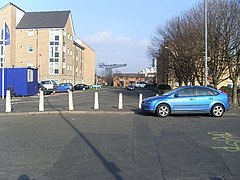
Kinning Park
Kinning Park
|
|
|---|---|
 Sussex Street |
|
| Kinning Park shown within Glasgow | |
| OS grid reference | NS571640 |
| Council area | |
| Lieutenancy area |
|
| Country | Scotland |
| Sovereign state | United Kingdom |
| Post town | GLASGOW |
| Postcode district | G41 |
| Dialling code | 0141 |
| Police | Scottish |
| Fire | Scottish |
| Ambulance | Scottish |
| EU Parliament | Scotland |
| UK Parliament | |
| Scottish Parliament | |
Kinning Park is a southern suburb of Glasgow, Scotland. In 1897 it had a population of 14,326.
Originally a separate police burgh founded in 1871, it became part of Glasgow in 1905. It was the smallest such burgh in Scotland at just 108 acres (0.44 km2). During its 34-year existence, the burgh had its own council, elections, coat of arms, provosts, town hall, council chambers, fire brigade, police force, and police court.Govan Burgh to the west survived even longer, from 1864-1912, before it too was annexed by the City of Glasgow.
The inaugural council in 1871 was one of the first examples of working class representation in Scotland with 5 "working men" candidates being elected to the 12 member council under the guidance of Andrew Boa, an activist who also served on the Glasgow Trades Council. This was well before the formation of the Scottish Labour Party in 1888 by Keir Hardie and Robert Bontine Cunninghame Graham.
During the area's time as an independent burgh, there were nine Provosts of Kinning Park:
More recently, political activity in the district has received national publicity in relation to the Glasgow headquarters of the Scottish Socialist Party (SSP) in Stanley Street which occupies a site adjacent to the former Kinning Park Burgh Chambers. This SSP building was the scene of the Executive Committee Emergency Meeting on 9 November 2004, which led to later disagreement between prominent Scottish politician Tommy Sheridan and many of his committee colleagues. The minutes of the meeting were disputed and they became a key point of discussion in the defamation case which Sheridan brought against the News of the World newspaper in 2006.
A map by Robert Ogilvy in 1741 of the estate of Sir John Maxwell of Pollok shows a field called "The Park" just to the west of the building "Kinnen House" (later Kinning House) and immediately south of what today is Paisley Road Toll, but up to the 19th century was called Parkhouse Toll. Hence, this proximity of "The Park" and "Kinning House" is likely to be the origin of the name Kinning Park as the area developed. "Kinning" could be linked to the Scots word "kinnen" ("cunig", "cuning", "cunyg" or "coney") meaning a rabbit. This would be consistent the naming of the neighbouring area of Ibrox after the old Scots term "Y brocks" meaning "the badgers". In nearby Pollokshields there was also once a half-mile long grassy valley called "The Cunyan", which existed immediately south of Fleurs Avenue and the railway line, until it was built over as part of the route of the M77 motorway in the mid-1970s.
...
Wikipedia

