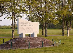
Knox County Regional Airport
| Knox County Regional Airport | |||||||||||||||
|---|---|---|---|---|---|---|---|---|---|---|---|---|---|---|---|
 |
|||||||||||||||
| Summary | |||||||||||||||
| Airport type | Public | ||||||||||||||
| Owner | Knox County | ||||||||||||||
| Serves | Rockland, Maine | ||||||||||||||
| Elevation AMSL | 56 ft / 17 m | ||||||||||||||
| Coordinates | 44°03′36″N 069°05′57″W / 44.06000°N 69.09917°WCoordinates: 44°03′36″N 069°05′57″W / 44.06000°N 69.09917°W | ||||||||||||||
| Website | KnoxCountyMaine.gov/... | ||||||||||||||
| Map | |||||||||||||||
| Location of airport in Maine / United States | |||||||||||||||
| Runways | |||||||||||||||
|
|||||||||||||||
| Statistics (2010) | |||||||||||||||
|
|||||||||||||||
|
Source: Federal Aviation Administration
|
|||||||||||||||
| Aircraft operations | 55,125 |
|---|---|
| Based aircraft | 79 |
Knox County Regional Airport (IATA: RKD, ICAO: KRKD, FAA LID: RKD) is a county owned, public use airport in Knox County, Maine, United States. It is located three nautical miles (6 km) south of the central business district of Rockland, Maine. The airport serves the residents of midcoast Maine with commercial and charter aviation services. Scheduled airline service is subsidized by the Essential Air Service program. It is also a major hub of freight and mail service to Maine's island communities including Matinicus, North Haven and Vinalhaven.
As per Federal Aviation Administration records, the airport had 13,866 passenger boardings (enplanements) in calendar year 2008, 14,461 enplanements in 2009, and 17,657 in 2010. It is included in the National Plan of Integrated Airport Systems for 2011–2015, which categorized it as a primary commercial service airport (more than 10,000 enplanements per year).
During the summer months, the airport is one of Maine's busiest, with significant private jet operations bringing visitors to the numerous summer colonies in the Penobscot Bay region. The influx in traffic in recent years prompted the implementation of a voluntary night curfew on arrivals and departures between 10:30 p.m. and 6:00 a.m.
...
Wikipedia


