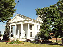
Lapeer County, Michigan
| Lapeer County, Michigan | |
|---|---|

|
|
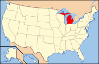
 Location in the U.S. state of Michigan |
|
 Michigan's location in the U.S. |
|
| Founded | September 18, 1822 (created) February 2, 1835 (organized) |
| Seat | Lapeer |
| Largest city | Lapeer |
| Area | |
| • Total | 663 sq mi (1,717 km2) |
| • Land | 643 sq mi (1,665 km2) |
| • Water | 20 sq mi (52 km2), 3.0% |
| Population | |
| • (2010) | 88,319 |
| • Density | 137/sq mi (53/km²) |
| Congressional district | 10th |
| Time zone | Eastern: UTC-5/-4 |
| Website | lapeercountyweb |
Lapeer County is a county located in the U.S. state of Michigan. As of the 2010 census, the population was 88,319. The county seat is Lapeer. The county was created on September 18, 1822, and was fully organized on February 2, 1835. The name is a corruption of the French la pierre, which means "the flint".
Lapeer County is included in the Detroit-Warren-Dearborn, MI Metropolitan Statistical Area.
Lapeer County was part of New France from 1534, and as New France gained in population, part of the Pays d'en Haut (upper countries) dependency of the Colony of Canada from its formation as a department of New France in 1712. In 1763 England took possession, then renamed the colony and its dependencies the Province of Quebec. France and England controlled trading by establishing forts to settle disputes and enforce laws, utilizing ancient overland and waterborne trade routes, while providing superior tools and weapons in exchange for valuable furs
Following the American Revolution, Great Britain ceded portions of the Province of Quebec to the United States of America. By an ordinance of the Congress of the United States passed in July 13, 1787, under the Articles of Confederation, the whole of the territory of the United States lying northwest of the Ohio River, though still occupied by the British, was organized as the Northwest Territory. The area that is now Lapeer County used to be a part of the County of Wayne, named in the honor of General Anthony Wayne. This original Wayne County was created on August 11, 1796, and included all of the lower peninsula of Michigan, parts of Northern Ohio and Indiana, and also portions of Wisconsin and Illinois.
...
Wikipedia
