Leetsdale, Pennsylvania
| Leetsdale | |
|---|---|
| Borough | |

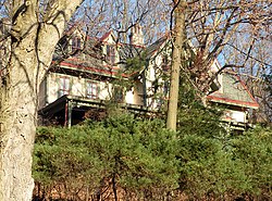
Elmridge, a historic site in the borough
|
|
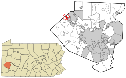
 Location in Allegheny County and the state of Pennsylvania |
|
| Coordinates: 40°34′0″N 80°12′41″W / 40.56667°N 80.21139°WCoordinates: 40°34′0″N 80°12′41″W / 40.56667°N 80.21139°W | |
| Country | United States |
| State | Pennsylvania |
| County | Allegheny |
| Incorporated | March 28, 1904 |
| Government | |
| • Mayor | Peter A. Poninsky |
| Area | |
| • Total | 1.1 sq mi (3 km2) |
| • Land | 1.0 sq mi (3 km2) |
| • Water | 0.2 sq mi (0.5 km2) |
| Population (2010) | |
| • Total | 1,218 |
| • Density | 1,100/sq mi (430/km2) |
| Time zone | Eastern (EST) (UTC-5) |
| • Summer (DST) | EDT (UTC-4) |
| Website | http://leetsdaleboro.net/ |
Leetsdale is a borough in Allegheny County, Pennsylvania, along the Ohio River. It is part of the Pittsburgh Metro Area. The population was 1,218 at the 2010 census.
Leetsdale was incorporated on March 28, 1904. Leetsdale at one time had a formidable industrial manufacturing base, with a Bethlehem Steel mill that closed in the late 1970s. The site of the mill on the shore of the Ohio River is now the Leetsdale Industrial Park, or the Port of Leetsdale, and is home to facilities leased to a number of companies of varying sizes.
Leetsdale is also home to Elmridge, or the James Gardiner Coffin/John Walker house, which is listed on the National Register of Historic Places.
Leetsdale is located at 40°34′0″N 80°12′41″W / 40.56667°N 80.21139°W (40.566667, -80.211274).
According to the United States Census Bureau, the borough has a total area of 1.1 square miles (2.8 km2), of which 1.0 square mile (2.6 km2) is land and 0.2 square miles (0.52 km2), or 13.91%, is water.
Leetsdale is bordered by Ambridge to the north, Leet Township to the northeast, and Edgeworth to the southeast. The borough includes the former town of Shields. The Ohio River forms the southwest border of the borough; across the river is Crescent Township.
...
Wikipedia
