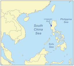
Lingayen Gulf
| Lingayen Gulf | |
|
Lingayen Gulf at San Fabian, Pangasinan, with the Cordillera Central mountains in the background.
|
|
| Country | Philippines |
|---|---|
| Region | Ilocos Region |
| Part of | South China Sea |
| Cities and towns | |
| Rivers | |
| Coordinates | 16°17′N 120°12′E / 16.283°N 120.200°ECoordinates: 16°17′N 120°12′E / 16.283°N 120.200°E |
| Length | 55 km (34 mi), N-S |
| Width | 35 km (22 mi), E-W |
The Lingayen Gulf is a large gulf on northwestern Luzon in the Philippines, stretching 56 km (35 mi). It is framed by the provinces of Pangasinan and La Union and sits between the Zambales Mountains and the Cordillera Central. The Agno River drains into Lingayen Gulf.
The gulf has numerous islands, the most famous of which are in the Hundred Islands National Park. This tourist attraction features 123 islands, the majority of which are small in size. The largest island is Cabarruyan Island, which constitutes the municipality of Anda, Pangasinan, followed by Santiago Island at the mouth of the Gulf.
The shore from Labrador to San Fabian is characterized by a long grey-sand beach. Other well-known beaches are at Bolinao and San Fernando City. The waters of Lingayen Gulf are murky due to its sandy bottom. Coral reefs were all but destroyed by dynamite fishing, although efforts are made to restore some, especially inside the Hundred Islands National Park.
A number of cities are found along the gulf's coast such as Dagupan City and Alaminos City in Pangasinan, and San Fernando City in La Union. Lingayen, the capital of Pangasinan, also lies on the shores of the gulf.
The gulf has five major river sources. Flowing from the province of Pangasinan in the south are the Agno, Dagupan and Angalacan-Bued rivers. From the east in the province of La Union flow the Aringay and Bauang rivers.
...
Wikipedia


