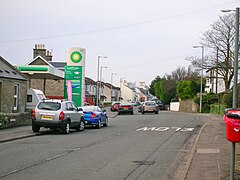
Loans, South Ayrshire
| Loans | |
|---|---|
 Main Street, Loans |
|
| Loans shown within South Ayrshire | |
| OS grid reference | NS3451031739 |
| Council area | |
| Lieutenancy area | |
| Country | Scotland |
| Sovereign state | United Kingdom |
| Post town | Troon |
| Dialling code | 01292 |
| Police | Scottish |
| Fire | Scottish |
| Ambulance | Scottish |
| EU Parliament | Scotland |
| UK Parliament | |
| Scottish Parliament | |
Loans is a village in South Ayrshire near Troon, Scotland. It is located in Dundonald Parish on the A759 at the junction with the B746 and a minor road to Dundonald. The A78 formerly ran though the settlement when it followed the course of the Irvine to Ayr turnpike. After the death of Colonel William Fullarton in 1808, the Fourth Duke of Portland purchased the Lands of Fullarton that included Loans, the Lady Isle and Crosbie.
Recorded as Loans, Lones, or Lons, the name of the village may have no connection with lending and be derived from the green loans or loaning (a piece of soft, rough ground) around the Bushie and Craiksland Burns, which joined each other at the foot the old orchard at Crossburn. A 'loan' can simply refer to a 'lane' and as such is a common placename element, which would be particularly appropriate to Loans, which is at a crossroads. Before the encloser of fields, a loan or strip of grass was left that ran through the arable part of a farm or farms, linking it with the common grazing ground of a clachan, serving both as a pasture and a driving road. A lon can mean a loan of land granted by the king, from which an income is derived to benefit an establishment or simply the Land of King Robert.
During feudal times, Robertloan House and Hillhouse were the seats of the local lairds. Fairs were held here in June and October of each year. In 1806 five small steadings comprised the settlement of Loans.
A school had been established at the Darley prior to 1840, however it had closed by 1866. In 1877 a school was built in the village itself. Teachers included Miss Jessie A. Meikle, Miss Shaw, Miss Baird, and Miss Martha Meikle.
Some of the old houses in Loans were little better than smuggling vaults, having double walls and many cargoes from the Isle of Man and Northern Ireland ended up hidden in the village. All around Loans, especially in sand hills, were 'brandy holes', being large pits the size of rooms used for storing brandy casks.
The village smithy was once situated on the main street, as was the post office.
The name Corseburn is first recorded at the time of the Highway Act of 1835. Crossburn Bridge was situated in the formation of the highway, constructed over what had previously been a ford of the Craiksland or Sculloch Burn crossed the highway as a ford until the Corseburn or Crossburn Bridge was built.
The Loans toll, at the foot of Crossburn Avenue came into use during the early years of the 18th century. There were two toll bars, both made of pine. These gates were leased out together or as separate entities. The village tolls added to their income by selling whisky and ale.
...
Wikipedia

