Loch Ryan
| Loch Ryan Loch Rìoghaine |
|
|---|---|

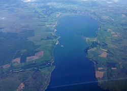
Aerial view of Loch Ryan.
|
|
| Location | Scottish Lowlands, Scotland |
| Coordinates | 54°59′10″N 5°03′18″W / 54.986°N 5.055°W |
| Type | Sea loch |
| Primary inflows | Water of App, Glen Burn |
| Primary outflows | North Channel |
| Catchment area | 197 km2 (76 sq mi) |
| Basin countries | Scotland |
| Max. length | 13.4 kilometers (8.3 mi) |
| Max. depth | 16 m (52 ft) |
| Surface elevation | 0 m (0 ft) |
| Settlements | Stranraer, Cairnryan, Kirkcolm |

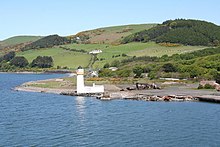
Cairn Point lighthouse viewed from the southwest in 2009
|
|
|
Scotland
|
|
| Location |
Cairnryan Dumfries and Galloway Scotland United Kingdom |
|---|---|
| Coordinates | 54°58′28″N 5°01′51″W / 54.974468°N 5.030861°WCoordinates: 54°58′28″N 5°01′51″W / 54.974468°N 5.030861°W |
| Year first constructed | 1847 |
| Automated | 1964 |
| Construction | masonry tower |
| Tower shape | cylindrical tower with balcony and lantern attached to 1-storey keeper’s house |
| Markings / pattern | white tower, black lantern, ochre trim |
| Height | 15 metres (49 ft) |
| Focal height | 14 metres (46 ft) |
| Light source | mains power |
| Range | 12 nautical miles (22 km; 14 mi) |
| Admiralty number | A4592 |
| NGA number | 4784 |
| ARLHS number | SCO-029 |
| Managing agent | Northern Lighthouse Board |
Loch Ryan (Gaelic: Loch Rìoghaine, pronounced [ɫ̪ɔx r̴iː.ɛɲə]) is a Scottish sea loch that acts as an important natural harbour for shipping, providing calm waters for ferries operating between Scotland and Northern Ireland. The town of Stranraer is the largest settlement on its shores, with ferries to and from Northern Ireland operating from Cairnryan further north on the loch.
Loch Ryan is orientated on a north-south axis, its mouth looking northward into the North Atlantic and Firth of Clyde, and the town of Stranraer sitting on its southern shores. The loch is bounded by the Rhins of Galloway peninsula on its western side and the Scottish landmass in the east (comprising Galloway and South Ayrshire), the northern points of the loch are Milleur Point and Finnarts Point. The loch itself is about 8 miles (13 km) long from north to south, and about 3 miles (4.8 km) wide at its widest point. Nearby roads include the A77 in the east and the A718 in the west. The Loch Ryan basin as it is seen today formed as a result of geological and glacial activity. The first period of activity occurred during the Paleozoic era, with two periods of change. Firstly, during the Devonian period (360 to 416 million years ago) the land in the area underwent a series of shearing events which considerably altered its shape, forming a basin. Then, during the Permian period (250 to 300 million years ago) this basin filled up with sediments which were compacted to form soft sandstones. At this point in time the area would have been positioned around the equator and would form part of the Pangaea supercontinent. The second period of activity was as a result of the numerous glacial episodes during the Quaternary period, from 2 million years ago up until the last glaciers retreated 10,000 years ago.
...
Wikipedia

