Mayville, North Dakota
| Mayville, North Dakota | |
|---|---|
| City | |

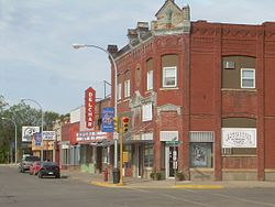
Downtown Mayville
|
|
 Location of Mayville, North Dakota |
|
| Coordinates: 47°29′59″N 97°19′32″W / 47.49972°N 97.32556°WCoordinates: 47°29′59″N 97°19′32″W / 47.49972°N 97.32556°W | |
| Country | United States |
| State | North Dakota |
| County | Traill |
| Founded | 1881 |
| Area | |
| • Total | 1.92 sq mi (4.97 km2) |
| • Land | 1.92 sq mi (4.97 km2) |
| • Water | 0 sq mi (0 km2) |
| Elevation | 971 ft (296 m) |
| Population (2010) | |
| • Total | 1,858 |
| • Estimate (2015) | 1,829 |
| • Density | 967.7/sq mi (373.6/km2) |
| Time zone | Central (CST) (UTC-6) |
| • Summer (DST) | CDT (UTC-5) |
| ZIP code | 58257 |
| Area code(s) | 701 Exchange: 786 |
| FIPS code | 38-51500 |
| GNIS feature ID | 1030125 |
| Highways | ND 18, ND 200 |
| Website | http://www.mayvilleportland.com/ |
Mayville is a city in Traill County, North Dakota, United States. The population was 1,858 at the 2010 census, which makes Mayville the largest community in Traill County. Mayville was founded in 1881. The city's name remembers May Arnold, the first white child born in the immediate area.
Mayville is often grouped with the neighboring city of Portland. The two towns are sometimes given the name May-Port. Mayville State University is located in Mayville.
Mayville is located at 47°29′59″N 97°19′32″W / 47.49972°N 97.32556°W (47.499830, -97.325545).
Mayville sits in the fertile Red River Valley on the banks of the Goose River. The Valley was once a part of glacial Lake Agassiz. As the glacier receded, it left the land very flat, but also very rich. The area around Mayville is prime agricultural land.
According to the United States Census Bureau, the city has a total area of 1.92 square miles (4.97 km2), all of it land.
In the summer of 2006, the community celebrated the city's 125th anniversary.
As of the census of 2010, there were 1,858 people, 773 households, and 384 families residing in the city. The population density was 967.7 inhabitants per square mile (373.6/km2). There were 872 housing units at an average density of 454.2 per square mile (175.4/km2). The racial makeup of the city was 94.2% White, 1.8% African American, 0.6% Native American, 0.2% Asian, 0.1% Pacific Islander, 0.9% from other races, and 2.2% from two or more races. Hispanic or Latino of any race were 2.0% of the population.
...
Wikipedia
