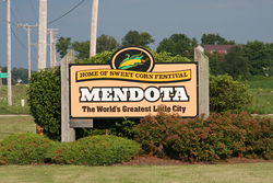
Mendota, Illinois
| Mendota, Illinois | |
|---|---|
| City | |

|
|
| Motto: The World's Greatest Little City | |
| Country | United States |
| State | Illinois |
| County | LaSalle |
| Incorporated | 1855 |
| Government | |
| • Type | Mayor |
| • Mayor | David W. Boelk (I) |
| Area | |
| • Total | 5.08 sq mi (13.16 km2) |
| • Land | 4.98 sq mi (12.90 km2) |
| • Water | 0.10 sq mi (0.26 km2) |
| Elevation | 741 ft (226 m) |
| Population (2014) | |
| • Total | 7,254 |
| • Density | 1,457/sq mi (562/km2) |
| Time zone | CST (UTC−6) |
| • Summer (DST) | CDT (UTC−5) |
| ZIP code | 61342 |
| Area code | 815, 779 |
| Website | http://www.mendota.il.us/ |
Mendota is a city in LaSalle County, Illinois, United States, in the state's north-central region. The population was 7,372 at the 2010 census, and was estimated to be 7,204 by July 2015. It is part of the Ottawa-Peru, IL Micropolitan Statistical Area. Mendota is located approximately 70 miles east of Moline and 55 miles south of Rockford. The current mayor is David W. Boelk, an independent elected to a four-year term.
Mendota is a name derived from a Native American word meaning "junction of two trails", which was found appropriate for the city since there was a nearby railroad junction.
Mendota is served by U.S Interstate 39, U.S. Route 34, U.S. Route 52, and many state highways including Illinois Route 251. Three Amtrak trains in each direction stop daily at the Mendota Amtrak station: the Illinois Zephyr and Carl Sandburg between Chicago and Quincy, and the Southwest Chief from Chicago to Kansas City and Los Angeles. (The California Zephyr passes through without stopping.) There are also two small airports near-by.
Mendota is located at 41°32′58″N 89°7′6″W / 41.54944°N 89.11833°W (41.549397, -89.118377).
...
Wikipedia

