Miguel Hidalgo, D.F.
| Miguel Hidalgo | |
|---|---|

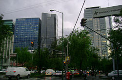
Polanco district in Miguel Hidalgo
|
|
 Location of Miguel Hidalgo in Mexico City |
|
| Area | |
| • Total | 26.96 sq mi (69.8 km2) |
| Population | |
| • Total | 372,889 |
| • Density | 14,000/sq mi (5,300/km2) |
| Website | http://www.miguelhidalgo.gob.mx |
Miguel Hidalgo is one of the 16 delegaciones (boroughs) into which Federal District of Mexico City is divided. It was created in 1970, joining the historic areas of Tacuba, Chapultepec and Tacubaya along with a number of notable neighborhoods such as Polanco and Lomas de Chapultepec. With landmarks such as Chapultepec Park and the Museo Nacional de Antropología, it is the second most visited borough in Mexico City after Cuauhtémoc, D.F. where the historic center of Mexico City is located. Tacubaya and Tacuba both have long histories as independent settlements and were designated as “Barrios Mágicos” by the city for tourism purposes.
The borough is located in the northwest Federal District of Mexico City, just west of the historic center. The borough is divided into eighty one neighborhoods called colonias. The largest of these is Bosques de las Lomas at 3.2km2, and the smallest is Popo Ampliación with only .33km2. It is bordered by the boroughs of Azcapotzalco, Cuauhtémoc, Benito Juárez, Álvaro Obregón and Cuajimalpa with the State of Mexico bordering it on the west side. It has a territory of 47.68km2 which is 3.17 percent of the total Federal District.
The borough consists of an area which used to the west bank of Lake Texcoco, with three major zones, Tacuba, Chapultepec and Tacubaya. The geography of the borough includes canyons, hills and mesas associated with the Sierra de las Cruces, most present in the southwest bordering Cuajimalpa. In the northeast, mostly defined by the Circuit Interior road, is the most important elevation, the Cerro de Chapultepec at 2,260masl. The area today is almost completely developed with green spaces mostly limited to parks. The largest green space is Chapultepec Park at 2.2 km2. Parque Lineal was the former rail line of the Ferrocarril de Cuernavaca. The strip was converted into a park in 2011. Where the park crosses Lago Constanza Street in Colonia Anáhuac, there are often cultural events held. One of the newest parks in the borough is located on Lago Caneguin in Colonia Argentina, created over a former roadway called Ruta 100. The unnamed park has 10,000 meters of surface area, kiosk, gymnasium, bicycle path, multipurpose room, parking, rain water containment system and child care center. It serves about 40,000 area residents. In 2008, reforestation efforts were undertaken, beginning at the Cañitas Park. While there were important rivers here such as Remedios, today there are no longer any free flowing currents of water. The climate is semi moist and temperate with annual rainfall varying between 700 and 800mm. The average annual temperature is 15C with lows in the winter about 8C and highs around 19C.
...
Wikipedia
