Montgomery Peak
| Montgomery Peak | |
|---|---|

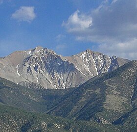
Montgomery Peak (right) and Boundary Peak
|
|
| Highest point | |
| Elevation | 13,447 ft (4,099 m) NAVD 88 |
| Prominence | 1,266 ft (386 m) |
| Listing | Desert Peaks Section List |
| Coordinates | 37°50′18″N 118°21′24″W / 37.8382642°N 118.3567847°WCoordinates: 37°50′18″N 118°21′24″W / 37.8382642°N 118.3567847°W |
| Geography | |
| Location | Mono County, California, U.S. |
| Parent range | White Mountains |
| Topo map | USGS Boundary Peak |
| Climbing | |
| Easiest route | Scramble, class 2 |
Montgomery Peak is a mountain in the White Mountains of California, USA. It is less than 1 mile (1.6 km) from Boundary Peak, the highest point in Nevada. It can be climbed in combination with Boundary Peak. The mountain is in the Inyo National Forest and White Mountains Wilderness.
...
Wikipedia
