Moore Dam
| Moore Dam | |
|---|---|

Satellite view
|
|
| Country | United States |
| Location | New Hampshire and Vermont |
| Coordinates | 44°20′09″N 71°52′29″W / 44.33583°N 71.87472°WCoordinates: 44°20′09″N 71°52′29″W / 44.33583°N 71.87472°W |
| Purpose | Hydroelectric |
| Construction began | 1954 |
| Opening date | 1956 |
| Owner(s) | TransCanada |
| Dam and spillways | |
| Type of dam | Embankment, gravity |
| Impounds | Connecticut River |
| Height (foundation) | 178 ft (54 m) |
| Length | 2,920 ft (890 m) |
| Spillway type | Gated overflow |
| Reservoir | |
| Total capacity | 223,722 acre⋅ft (275,957,000 m3) |
| Catchment area | 1,514 sq mi (3,920 km2) |
| Surface area | 3,490 acres (1,410 ha) |
| Normal elevation | 809 ft (247 m) |
| Moore Station | |
| Type | Conventional |
| Hydraulic head | 150 ft (46 m) |
| Turbines | 4x 56,400 HP Francis |
| Installed capacity | 140.4 MW (rated) |
| Annual generation | 314,300,000 KWh (2009) |
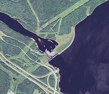
Moore Dam is a major hydroelectric dam on the Upper Connecticut River between Grafton County, New Hampshire and Caledonia County, Vermont in the northeastern United States. The dam is located near Littleton, New Hampshire, and forms the 3,490-acre (1,410 ha) Moore Reservoir. The Moore Station is the largest conventional hydroelectric plant in New England, in terms of installed capacity and average power generation. The dam and reservoir also provide flood control, recreational boating and fishing.
The official name of the dam is the Samuel C. Moore Dam, after a former president of the now defunct New England Power Company that originally built it. The dam, reservoir and power station are now owned and operated by TransCanada Corporation.
The Moore Dam is the uppermost feature of the Fifteen Miles Falls hydroelectric project, which began development in the early 1900s by New England Power (later USGen New England). Before damming, the "Fifteen Miles Falls" was a fast flowing whitewater section of the Connecticut River, where it dropped 350 feet (110 m) over the course of 15 miles (24 km), making it the longest single stretch of whitewater in the northeastern US. The steep grade and heavy flow also made it ideal for the construction of water mills, and later, hydroelectric plants. In 1908 Carl A. Ross of Littleton pitched the proposal to Massachusetts investors who agreed to finance the project. The two lower plants, Comerford Dam 8 miles (13 km) downstream and McIndoe Dam 14 miles (23 km) downstream, were completed in 1930 and 1931 respectively.
Site preparations for Moore Reservoir commenced in the mid-1930s, with the clearing of over 3,000 acres of farmland and forest to allow for future flooding. The towns of Upper Waterford, Vermont and Pattenville, New Hampshire were demolished; however, with the onset of the Great Depression preliminary work on Moore Dam was halted. Construction was not resumed until 1954, and was completed in 1956, at a cost of $41 million. The dam was dedicated, and power generation begun, on June 20, 1957.
...
Wikipedia


