Osceola County, Florida
| Osceola County, Florida | |||
|---|---|---|---|

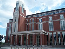
The Osceola County courthouse in October 2009
|
|||
|
|||
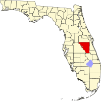
 Location in the U.S. state of Florida |
|||
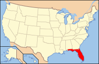
 Florida's location in the U.S. |
|||
| Founded | May 12, 1887 | ||
| Named for | Osceola | ||
| Seat | Kissimmee | ||
| Largest city | Kissimmee | ||
| Area | |||
| • Total | 1,506 sq mi (3,901 km2) | ||
| • Land | 1,327 sq mi (3,437 km2) | ||
| • Water | 178 sq mi (461 km2), 11.9% | ||
| Population (est.) | |||
| • (2015) | 323,993 | ||
| • Density | 244/sq mi (94.3/km²) | ||
| Congressional district | 9th | ||
| Time zone | Eastern: UTC-5/-4 | ||
| Website | www |
||
Osceola County (/ɒsiˈoʊlə/, o-si-OH-lə) is a county located in the U.S. state of Florida. As of the 2010 census, the population was 268,685. Its county seat is Kissimmee.
Osceola County is included in the Orlando-Kissimmee-Sanford, Fla. Metropolitan Statistical Area.
Osceola County is named for the Indian leader Osceola, whose name means "Black Drink Cry [Asi Yaholo]".
Osceola County was created in 1887. On July 21, 1821, Florida was divided into two counties, named Escambia County to the west and St. John's County to the east. In 1824, the southern part of St. John's County became Mosquito County, with Enterprise as the county seat. In 1844, Brevard County was carved out from Mosquito County. When Florida became a state in 1845, Mosquito County was renamed Orange County. On May 12, 1887, Osceola was named a county, having been created from both Orange and Brevard Counties. Osceola County reached all the way down to Lake Okeechobee until 1917 when Okeechobee County was formed.
...
Wikipedia


