Prowers County, Colorado
| Prowers County, Colorado | |
|---|---|

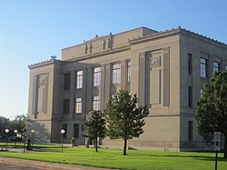
Prowers County Courthouse in Lamar
|
|
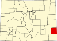
 Location in the U.S. state of Colorado |
|
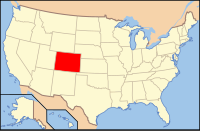
 Colorado's location in the U.S. |
|
| Founded | April 11, 1889 |
| Named for | John W. Prowers |
| Seat | Lamar |
| Largest city | Lamar |
| Area | |
| • Total | 1,644 sq mi (4,258 km2) |
| • Land | 1,638 sq mi (4,242 km2) |
| • Water | 5.9 sq mi (15 km2), 0.4% |
| Population (est.) | |
| • (2015) | 11,954 |
| • Density | 7.7/sq mi (3/km²) |
| Congressional district | 4th |
| Time zone | Mountain: UTC-7/-6 |
| Website | www |
Prowers County is one of the 64 counties in the U.S. state of Colorado. As of the 2010 census, the population was 12,551. The county seat is Lamar. The county is named in honor of John W. Prowers, a leading pioneer in the lower Arkansas valley region.
According to the U.S. Census Bureau, the county has a total area of 1,644 square miles (4,260 km2), of which 1,638 square miles (4,240 km2) is land and 5.9 square miles (15 km2) (0.4%) is water.
Prowers County is home of the Antipode of La Roche Godon making it one of the few places in the continental United States with a non-oceanic antipode.
As of the census of 2000, there were 14,483 people, 5,307 households, and 3,725 families residing in the county. The population density was 9 people per square mile (3/km²). There were 5,977 housing units at an average density of 4 per square mile (1/km²). The racial makeup of the county was 78.57% White, 0.30% Black or African American, 1.22% Native American, 0.37% Asian, 0.03% Pacific Islander, 17.17% from other races, and 2.34% from two or more races. 32.91% of the population were Hispanic or Latino of any race.
...
Wikipedia
