Riverside County, California
| Riverside County, California | |||||||||
|---|---|---|---|---|---|---|---|---|---|
| County | |||||||||
| County of Riverside | |||||||||
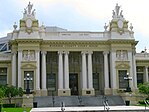
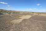
Images, from top down, left to right: Riverside Skyline, Riverside County Courthouse, Downtown Palm Springs, Lake Perris, the North face of the San Jacinto Mountains in the Santa Rosa and San Jacinto Mountains National Monument, Old Town Temecula, the Blythe Intaglios
|
|||||||||
|
|||||||||
 Location in the state of California |
|||||||||
 California's location in the United States |
|||||||||
| Country | |||||||||
| State |
|
||||||||
| Region | Inland Empire | ||||||||
| Incorporated | May 9, 1893 | ||||||||
| Named for |
|
||||||||
| County seat | Riverside | ||||||||
| Largest city (population) | Riverside | ||||||||
| Government | |||||||||
| • Board of Supervisors |
Supervisors
|
||||||||
| Area | |||||||||
| • Total | 7,303 sq mi (18,910 km2) | ||||||||
| • Land | 7,206 sq mi (18,660 km2) | ||||||||
| • Water | 97 sq mi (250 km2) | ||||||||
| Highest elevation | 10,843 ft (3,305 m) | ||||||||
| Lowest elevation | -234 ft (−71 m) | ||||||||
| Population (April 1, 2010) | |||||||||
| • Total | 2,189,641 | ||||||||
| • Estimate (2015) | 2,361,026 | ||||||||
| • Density | 300/sq mi (120/km2) | ||||||||
| Time zone | Pacific Time Zone (UTC-8) | ||||||||
| • Summer (DST) | Pacific Daylight Time (UTC-7) | ||||||||
| FIPS code | 06-065 | ||||||||
| GNIS feature ID | 277297 | ||||||||
| Website | www |
||||||||
Riverside County, California is one of fifty-eight counties in the U.S. state of California. As of the 2010 census, the population was 2,189,641, making it the 4th-most populous county in California and the 11th-most populous in the United States. The name was derived from the city of Riverside, which is the county seat.
Riverside County is included in the Riverside-San Bernardino-Ontario, CA Metropolitan Statistical Area, also known as the Inland Empire. The county is also included in the Los Angeles-Long Beach, CA Combined Statistical Area. There is a high concentration of sprawling tract housing communities around Riverside and along the Interstate 10, 15, and 215 freeways.
Roughly rectangle-shaped, Riverside County covers 7,208 square miles (18,670 km2) in Southern California, spanning from the Greater Los Angeles area to the Arizona border. Geographically, the county is mostly desert in the central and eastern portions, but has a Mediterranean climate in the western portion. Most of Joshua Tree National Park is located in the county.
The resort cities of Palm Springs, Palm Desert, Indian Wells, La Quinta, Rancho Mirage, and Desert Hot Springs are all located in the Coachella Valley region of Riverside County. Large numbers of Los Angeles area workers have moved to the county in recent years (data from the US Census Bureau for 2007 through 2011) to take advantage of relatively affordable housing. Along with neighboring San Bernardino County, it was one of the fastest growing regions in the state prior to the recent changes in the regional economy. In addition, smaller, but significant, numbers of people have been moving into Southwest Riverside County from the San Diego-Tijuana metropolitan area. The cities of Temecula and Murrieta accounted for 20% of the increase in population of the county between 2000 and 2007.
...
Wikipedia


