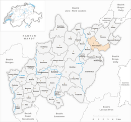
Saint-Cierges, Switzerland
| Saint-Cierges | ||
|---|---|---|
| Former municipality of Switzerland | ||
|
||
| Coordinates: 46°41′N 6°44′E / 46.683°N 6.733°ECoordinates: 46°41′N 6°44′E / 46.683°N 6.733°E | ||
| Country | Switzerland | |
| Canton | Vaud | |
| District | Gros-de-Vaud | |
| Area | ||
| • Total | 6.44 km2 (2.49 sq mi) | |
| Elevation | 758 m (2,487 ft) | |
| Population (2011) | ||
| • Total | 472 | |
| • Density | 73/km2 (190/sq mi) | |
| Postal code | 1064 | |
| SFOS number | 5685 | |
| Surrounded by | Bercher, Boulens, Chapelle-sur-Moudon, Moudon, Neyruz-sur-Moudon, Ogens, Thierrens | |
| Website |
www Profile (French), SFSO statistics |
|
Saint-Cierges is a former municipality in the district of Gros-de-Vaud in the canton of Vaud in Switzerland. Its name refers to Saint Cyriacus, who is the town's patron saint. The municipalities of Chapelle-sur-Moudon, Correvon, Denezy, Martherenges, Neyruz-sur-Moudon, Peyres-Possens, Saint-Cierges, Thierrens and Chanéaz merged on 1 January 2013 into the new municipality of Montanaire.
Saint-Cierges is first mentioned around 1145-54 as de sancto Sergio. In 1166 it was mentioned as de sancto Ciriaco.
Saint-Cierges had an area, as of 2009[update], of 6.4 square kilometers (2.5 sq mi). Of this area, 3.94 km2 (1.52 sq mi) or 61.2% is used for agricultural purposes, while 2.18 km2 (0.84 sq mi) or 33.9% is forested. Of the rest of the land, 0.31 km2 (0.12 sq mi) or 4.8% is settled (buildings or roads) and 0.02 km2 (4.9 acres) or 0.3% is unproductive land.
Of the built up area, housing and buildings made up 3.1% and transportation infrastructure made up 1.2%. Out of the forested land, all of the forested land area is covered with heavy forests. Of the agricultural land, 44.9% is used for growing crops and 14.9% is pastures, while 1.4% is used for orchards or vine crops.
The former municipality was part of the Moudon District until it was dissolved on 31 August 2006, and Saint-Cierges became part of the new district of Gros-de-Vaud.
The former municipality is located on a plateau in the Jorat between the Broye and Mentue rivers. It consists of the village of Saint-Cierges and the hamlets of Corrençon, Pré-de-Place and Solitude.
...
Wikipedia


