Sioux Lookout
| Sioux Lookout | |
|---|---|
| Municipality (single-tier) | |
| Municipality of Sioux Lookout | |
 |
|
| Motto: Hub of the North | |
| Coordinates: 50°06′N 91°55′W / 50.100°N 91.917°WCoordinates: 50°06′N 91°55′W / 50.100°N 91.917°W | |
| Country |
|
| Province |
|
| District | Kenora |
| Incorporation | 1912 |
| Government | |
| • Mayor | Doug Lawrance |
| • Council |
List of councilors
|
| • MP | Bob Nault |
| • MPPs | Sarah Campbell |
| Area | |
| • Land | 378.82 km2 (146.26 sq mi) |
| Elevation | 383.10 m (1,256.89 ft) |
| Population (2011) | |
| • Total | 5,037 |
| • Density | 13.3/km2 (34/sq mi) |
| Time zone | CST (UTC−6) |
| • Summer (DST) | CDT (UTC−5) |
| Postal code FSA | P8T |
| Area code(s) | 807 |
| Website | www.siouxlookout.ca |
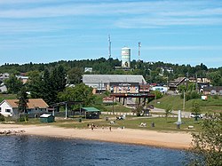
Sioux Lookout is a town in Northwestern Ontario, Canada. It has a population of about 5,000 people and an elevation of 390 metres (1,280 ft). Known locally as the "Hub of the North", it is serviced by the Sioux Lookout Airport, Highway 72, and the Sioux Lookout railway station. Tourism, lumber, and health care are the primary sources of employment in the town.
There are a number of fishing camps in the area that allow access to an extensive lake system fed by the English River. The town is surrounded by several beaches, including Umphreville Park, a historical site that predates the town itself. During the summer months, Sioux Lookout's population rises as tourists, most of whom are American, arrive to take advantage of the multitude of lakes and rivers in the area. Experienced guides, employed by the camps, can locate the best locations and also provide an educated tour of the unique land known affectionately as "sunset country".
In addition to the town of Sioux Lookout itself, the municipal boundaries include the community of Hudson and the railway point Pelican, located west on the Canadian National Railway (CNR) transcontinental main line; the railway point Superior Junction located on the CNR transcontinental main line to the east; and the railway point Alcona, located on a CNR branch line to the south east and south of Superior Junction.
Sioux Lookout's name comes from a local mountain and First Nations story. This mountain, known as Sioux Mountain, was used in the late 18th century by Ojibway People to watch for any oncoming Sioux warriors looking to ambush their camp. A careful eye could see the sun shining off the birch of enemy canoes crossing nearby rapids. Women and children could be led away safely while the warriors could intercept the Sioux on the water. Illustrating this old story on the front page of the local newspaper, The Sioux Lookout Bulletin, is an iconic image of a First Nations man, holding a hand above his eyes to scan the waters.
...
Wikipedia

