South Charleston, West Virginia
| City of South Charleston | |
|---|---|
| City | |

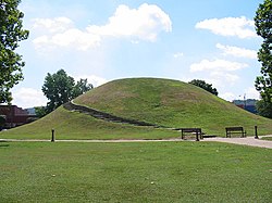
The Criel Mound in South Charleston.
|
|
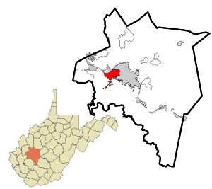
 Location in Kanawha County and state of West Virginia. |
|
| Coordinates: 38°21′9″N 81°42′43″W / 38.35250°N 81.71194°WCoordinates: 38°21′9″N 81°42′43″W / 38.35250°N 81.71194°W | |
| Country |
|
| State |
|
| County | Kanawha |
| Government | |
| • Mayor | Frank A. Mullens, Jr. (R) |
| Area | |
| • City | 8.51 sq mi (22.04 km2) |
| • Land | 7.61 sq mi (19.71 km2) |
| • Water | 0.90 sq mi (2.33 km2) |
| Elevation | 604 ft (183 m) |
| Population (2010) | |
| • City | 13,450 |
| • Estimate (2014) | 13,214 |
| • Density | 1,767.4/sq mi (682.4/km2) |
| • Urban | 153,199 (US: 214th) |
| • Metro | 222,878 (US: 198th) |
| Time zone | EST (UTC-5) |
| • Summer (DST) | EDT (UTC-4) |
| ZIP codes | 25303, 25309 |
| Area code(s) | 304 |
| FIPS code | 54-75292 |
| GNIS feature ID | 1555663 |
| Website | City of South Charleston |
South Charleston is a city in Kanawha County, West Virginia, United States The population was 13,450 at the 2010 census. South Charleston was established in 1906, but not incorporated until 1919 by special charter enacted by the West Virginia Legislature. Its name is based on the city being located primarily on the south side of the Kanawha River, although it is actually northwest, not south, of the city of Charleston.
The city is serviced by Interstate 64, U.S. Route 60, U.S. Route 119, West Virginia Route 601 and West Virginia Route 214, and is bisected by the Kanawha River. The city is serviced by the Kanawha Valley Regional Transportation Authority bus system. A general aviation airfield, Mallory Airport, is located off Chestnut Street, approximately two miles south of U.S. Route 60, with the nearest commercial aviation service being at Yeager Airport in Charleston. South Charleston serves as the headquarters to the West Virginia State Police.
South Charleston is located at 38°21′9″N 81°42′43″W / 38.35250°N 81.71194°W (38.352455, -81.712001).
...
Wikipedia
