Southport (UK Parliament constituency)
| Southport | |
|---|---|
|
Borough constituency for the House of Commons |
|

Boundary of Southport in Merseyside.
|
|

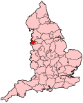
Location of Merseyside within England.
|
|
| County | Merseyside |
| Electorate | 67,803 (December 2010) |
| Major settlements | Southport |
| Current constituency | |
| Created | 1885 |
| Member of parliament | John Pugh (Liberal Democrat) |
| Number of members | One |
| Overlaps | |
| European Parliament constituency | North West England |
Coordinates: 53°38′49″N 3°00′25″W / 53.647°N 3.007°W
Southport is a constituency represented in the House of Commons of the UK Parliament since 2001 by John Pugh, a Liberal Democrat.
The constituency covers the whole town of Southport and the localities of Ainsdale, Birkdale, Blowick, Churchtown, Crossens, Highpark, Hillside, Kew, Marshside, Meols Cop, and Woodvale.
The constituency is bordered to the north by South Ribble, to the east by West Lancashire, and to the south by Sefton Central.
...
Wikipedia
