St. John, Kansas
| St. John, Kansas | |
|---|---|
| City | |
 Location within Stafford County and Kansas |
|
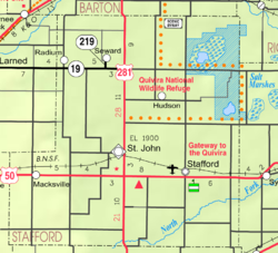
 KDOT map of Stafford County (legend) |
|
| Coordinates: 38°0′8″N 98°45′36″W / 38.00222°N 98.76000°WCoordinates: 38°0′8″N 98°45′36″W / 38.00222°N 98.76000°W | |
| Country | United States |
| State | Kansas |
| County | Stafford |
| Government | |
| • Type | Mayor–Council |
| Area | |
| • Total | 1.88 sq mi (4.87 km2) |
| • Land | 1.88 sq mi (4.87 km2) |
| • Water | 0 sq mi (0 km2) |
| Elevation | 1,903 ft (580 m) |
| Population (2010) | |
| • Total | 1,295 |
| • Estimate (2015) | 1,225 |
| • Density | 690/sq mi (270/km2) |
| Time zone | Central (CST) (UTC-6) |
| • Summer (DST) | CDT (UTC-5) |
| ZIP code | 67576 |
| Area code | 620 |
| FIPS code | 20-62275 |
| GNIS feature ID | 0473574 |
| Website | StJohnKansas.com |
St. John is a city in and the county seat of Stafford County, Kansas, United States. As of the 2010 census, the city population was 1,295.
The first settlement in what is today St. John was made in 1875 when William Bickerton of the Church of Jesus Christ founded a religious colony named Zion Valley. By 1879, Zion Valley had grown into a small town, and the residents renamed it St. John, after then governor John P. St. John, in order to gain favor in winning the county seat of Stafford County.
In 2015, due to diligent work of local citizens and former local graduates, the official government listing of locations has been corrected to spell the town correctly as "St. John" instead of "Saint John" that was incorrectly changed by the United States Postal Service in the 1970s.
St. John is located at 38°0′8″N 98°45′36″W / 38.00222°N 98.76000°W (38.0022371, -98.7600887). According to the United States Census Bureau, the city has a total area of 1.88 square miles (4.87 km2), all of it land.
As of the census of 2010, there were 1,295 people, 534 households, and 336 families residing in the city. The population density was 688.8 inhabitants per square mile (265.9/km2). There were 642 housing units at an average density of 341.5 per square mile (131.9/km2). The racial makeup of the city was 92.4% White, 0.2% African American, 1.2% Native American, 0.8% Asian, 4.2% from other races, and 1.2% from two or more races. Hispanic or Latino of any race were 15.1% of the population.
...
Wikipedia
