St. Stephens, Alabama
| St. Stephens, Alabama | |
|---|---|

St. Stephens Courthouse in "New" St. Stephens, completed in 1854.
|
|
| Location within the state of Alabama | |
| Coordinates: 31°32′25″N 88°3′19″W / 31.54028°N 88.05528°WCoordinates: 31°32′25″N 88°3′19″W / 31.54028°N 88.05528°W | |
| Country | United States |
| State | Alabama |
| County | Washington |
| Elevation | 226 ft (69 m) |
| Time zone | Central (CST) (UTC-6) |
| • Summer (DST) | CDT (UTC-5) |
| ZIP code | 36569 |
| Area code(s) | 251 |
|
Old St. Stephens Site
|
|

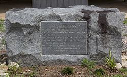
Marker placed by the Alabama Centennial Commission in 1922
|
|
| Nearest city | St. Stephens, Alabama |
|---|---|
| Area | 74 acres (30 ha) |
| NRHP Reference # | |
| Added to NRHP | December 29, 1970 |
St. Stephens is an unincorporated census-designated place in Washington County, Alabama, United States. As of the 2010 census, its population was 495. Located near the Tombigbee River in the southwestern part of the state and 67 miles north of Mobile, it is composed of two distinct sites: Old St. Stephens and New St. Stephens. The Old St. Stephens site lies directly on the river and is no longer inhabited. It was the territorial capital of the Alabama Territory. Now encompassed by the Old St. Stephens Historical Park, it is listed on the National Register of Historic Places.
Changes in the territorial capital and transportation resulted in the Old St. Stephens site being bypassed by development. "New" St. Stephens developed two miles inland around a railway station, but adjacent to the old site. It is the location of the post office, Baptist and Methodist churches, and residences. It has one building listed on the National Register and another on the Alabama Register of Landmarks and Heritage.
St. Stephens first appeared on the 1890 U.S. Census as an unincorporated village. It did not reappear again until 2010 when it was classified as a census-designated place (CDP).
Old St. Stephens was situated on a limestone bluff that the Native Americans called Hobucakintopa, at the fall line along the Tombigbee River where rocky shoals forced the end of navigation for boats traveling north from Mobile, 67 miles to the south. As early as 1772, British surveyor Bernard Romans noted that "sloops and schooners may come up to this rapid; therefore, I judge some considerable settlement will take place." By 1789, with the area back under Spanish control, the governor of Mobile, Juan Vincente Folch, established a fort and outpost here. By 1796 over 190 white inhabitants, mostly settlers from the United States, and their 97 or so slaves were living around the fort. With the Treaty of San Lorenzo, Spain turned the fort over to the United States government on February 5, 1799. It was included in the Mississippi Territory.
...
Wikipedia


