Taebaek
|
Taebaek 태백시 |
|
|---|---|
| Municipal City | |
| Korean transcription(s) | |
| • Hangul | |
| • Hanja | |
| • Revised Romanization | Taebaek-si |
| • McCune-Reischauer | T'aebaek-si |
 |
|
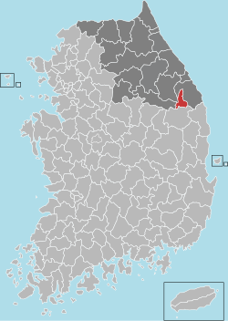
 Location in South Korea |
|
| Coordinates: 37°10′N 128°59′E / 37.167°N 128.983°E | |
| Country |
|
| Region | Gwandong |
| Administrative divisions | 8 dong |
| Area | |
| • Total | 303.53 km2 (117.19 sq mi) |
| Population (2001) | |
| • Total | 56,193 |
| • Density | 185/km2 (480/sq mi) |
| • Dialect | Gangwon |
| Climate | Dfb |
Taebaek is a city in Gangwon province, South Korea. Its name is shared with that of the Taebaek Mountains. Situated in 650 m ~ 700 m, Taebaek is the highest city in South Korea.
Manggyeongsa Temple in Hyeol-dong, at an altitude of 1,460 meters on the Taebaek Mountains, is a temple built to enshrine the statue of the Bodhisattva of wisdom. It was built by Jajang, a Silla Dynasty monk. The "Dragon Spring" at the entrance of the temple is known as the highest spring in Korea.
Coordinates: 37°10′N 128°59′E / 37.167°N 128.983°E
...
Wikipedia
