Taos County, New Mexico
| Taos County, New Mexico | ||
|---|---|---|

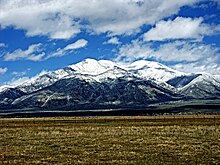
Taos Mountain from El Prado
|
||
|
||
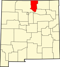
 Location in the U.S. state of New Mexico |
||
 New Mexico's location in the U.S. |
||
| Founded | January 9, 1852 | |
| Seat | Taos | |
| Largest town | Taos | |
| Area | ||
| • Total | 2,204 sq mi (5,708 km2) | |
| • Land | 2,203 sq mi (5,706 km2) | |
| • Water | 1.3 sq mi (3 km2), 0.06% | |
| Population (est.) | ||
| • (2015) | 32,907 | |
| • Density | 15/sq mi (6/km²) | |
| Congressional district | 3rd | |
| Time zone | Mountain: UTC-7/-6 | |
| Website | www |
|
Taos County is a county located in the U.S. state of New Mexico. As of the 2010 census, the population was 32,937. Its county seat is Taos. The county was formed in 1852 as one of the original nine counties in New Mexico Territory.
Taos County comprises the Taos, NM Micropolitan Statistical Area.
According to the U.S. Census Bureau, the county has a total area of 2,204 square miles (5,710 km2), of which 2,203 square miles (5,710 km2) is land and 1.3 square miles (3.4 km2) (0.06%) is water.
The highest point in the county is the summit of Wheeler Peak at 13,161 feet (4,011 m). This is also the highest natural point in the state of New Mexico. The county has the highest mean elevation of any U.S. county outside of Colorado, even though it ranks only 22nd overall. Taos County contains 17 of New Mexico's highest 25 peaks.
As of the census of 2000, there were 29,979 people, 12,675 households, and 7,757 families residing in the county. The population density was 14 people per square mile (5.2537/km²). There were 17,404 housing units at an average density of 8 per square mile (3.0500/km²). The racial makeup of the county was 63.77% White, 0.35% Black or African American, 6.59% Native American, 0.38% Asian, 0.12% Pacific Islander, 24.84% from other races, and 3.95% from two or more races. Hispanic or Latino of any race were 57.94% of the population.
...
Wikipedia

