Taunton River
| Taunton River | |
| Taunton Great River | |
| River | |
|
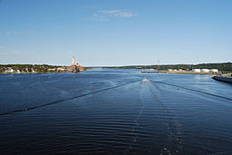
View of Taunton River looking north from the Veterans Memorial Bridge
|
|
| Country | United States |
|---|---|
| State | Massachusetts |
| Cities | Bridgewater, Taunton, Fall River |
| Mouth | Mount Hope Bay |
| Length | 36 mi (58 km) |
The Taunton River (historically also called the "Taunton Great River"), is a river in southeastern Massachusetts in the United States. It arises from the confluence of the Town River and Matfield River, in the town of Bridgewater. From there it meanders through the towns of Halifax, Middleborough and Raynham, through the city of Taunton for which it is named, the towns of Berkley, Dighton, Somerset, and the Assonet section of Freetown, to Fall River where it joins Mount Hope Bay, an arm of Narragansett Bay.
The total length of the river is 37.0 miles (59.5 km) from the junction of the Town and Matfield Rivers in Bridgewater to the mouth of the Quequechan River in Fall River. It has a watershed of 562 square miles (1,456 km²). The river's watershed includes the Hockomock Swamp, the largest freshwater wetland in the state. The Taunton River is one of the flattest rivers in New England, dropping only about twenty feet (6 m) in elevation over its length. The river is tidal as far north as Taunton.
...
Wikipedia

