Telemarksveien
| National Road 41 | |
|---|---|
| Norwegian: Riksvei 41 Nynorsk: Riksveg 41 |
|
|
|
|
 |
|
| Route information | |
| Maintained by Norwegian Public Roads Administration | |
| Length: | 172.9 km (107.4 mi) |
| Major junctions | |
| North end: | E134 at Brunkeberg, Kviteseid |
| 406 at Senumstad | |
| South end: | E18 at Hånes, Kristiansand |
| Highway system | |
| National Roads in Norway | |
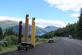
Norwegian National Road 41 (Rv 41; also known as the Telemarksveien) is a Norwegian national road that runs through Telemark, Aust-Agder, and Vest-Agder counties in Norway. The road runs between the village of Brunkeberg in Kviteseid municipality in Telemark county in the north and Timenes in Hånes in the city of Kristiansand in Vest-Agder county in the south. The 172.9-kilometre (107.4 mi) long road connects to the European route E134 highway in the north and to the European route E18 highway in the south. The road runs for 12.5 kilometres (7.8 mi) in Vest-Agder county, 89 kilometres (55 mi) in Aust-Agder county, and 71.4 kilometres (44.4 mi) in Telemark county. The southern half of the road runs along the river Tovdalselva and the lake Herefossfjorden, and it is located in a fault zone called the Kristiansand-Porsgrunn grabenen.
...
Wikipedia


