Yuma County, Colorado
| Yuma County, Colorado | |
|---|---|

The Yuma County Court-House in Wray.
|
|
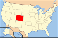
 Location in the U.S. state of Colorado |
|
 Colorado's location in the U.S. |
|
| Founded | March 15, 1889 |
| Seat | Wray |
| Largest city | Yuma |
| Area | |
| • Total | 2,369 sq mi (6,136 km2) |
| • Land | 2,364 sq mi (6,123 km2) |
| • Water | 4.3 sq mi (11 km2), 0.2% |
| Population (est.) | |
| • (2015) | 10,146 |
| • Density | 4.2/sq mi (2/km²) |
| Congressional district | 4th |
| Time zone | Mountain: UTC-7/-6 |
| Website | www |
Yuma County is one of the 64 counties of the U.S. state of Colorado. As of the 2010 census, the population was 10,043. The county seat is Wray.
According to the U.S. Census Bureau, the county has a total area of 2,369 square miles (6,140 km2), of which 2,364 square miles (6,120 km2) is land and 4.3 square miles (11 km2) (0.2%) is water.
The point where the Arikaree River flows out of Yuma County and into Cheyenne County, Kansas is the lowest point in the State of Colorado at 1,010 meters (3,315 feet) elevation. This crossing point holds the distinction of being the highest low point of any U.S. state.
As of the census of 2000, there were 9,841 people, 3,800 households, and 2,644 families residing in the county. The population density was 4 people per square mile (2/km²). There were 4,295 housing units at an average density of 2 per square mile (1/km²). The racial makeup of the county was 94.17% White, 0.11% Black or African American, 0.28% Native American, 0.07% Asian, 0.02% Pacific Islander, 4.14% from other races, and 1.21% from two or more races. 12.88% of the population were Hispanic or Latino of any race.
...
Wikipedia
