Lake County, Colorado
| Lake County, Colorado | ||
|---|---|---|
|
||
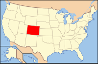
 Location in the U.S. state of Colorado |
||
 Colorado's location in the U.S. |
||
| Founded | November 1, 1861 | |
| Named for | Twin Lakes in the area | |
| Seat | Leadville | |
| Largest city | Leadville | |
| Area | ||
| • Total | 384 sq mi (995 km2) | |
| • Land | 377 sq mi (976 km2) | |
| • Water | 7.0 sq mi (18 km2), 1.8% | |
| Population (est.) | ||
| • (2015) | 7,485 | |
| • Density | 19/sq mi (7/km²) | |
| Congressional district | 3rd | |
| Time zone | Mountain: UTC-7/-6 | |
| Website | www |
|
Lake County is one of the 64 counties in the U.S. state of Colorado. As of the 2010 census, the population was 7,310. The county seat and the only municipality in the county is Leadville. The highest natural point in Colorado and the entire Rocky Mountains is the summit of Mount Elbert in Lake County at 14,440 feet (4401.2 meters) elevation.
Lake County was one of the original 17 counties created by the Colorado legislature on November 1, 1861. As originally defined, Lake County included a large portion of western Colorado to the south and west of its present boundaries. The county was named for Twin Lakes.
Placer gold was found at Colorado Gulch in 1863 as part of the Colorado Gold Rush.
Lake County slowly lost territory over the succeeding decades, losing land in its southeast to Saguache County in 1866 and Hinsdale County in 1874; in its southwest to La Plata County in 1874 and San Juan County in 1876, and in its west to Ouray and Gunnison counties in 1877.
With its many reductions in size, Lake County's designated county seat also changed multiple times within just a few years, residing successively in Oro City (from 1861), Lourette (from 1863), Dayton (from 1866), and Granite (from 1868).
...
Wikipedia

