Youngtown, Arizona
| Youngtown, Arizona | ||
|---|---|---|
| Town | ||

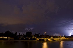
Maricopa Lake in a thunderstorm, Youngtown
|
||
|
||
| Motto: "First in Concept - Fostering Community Pride - Building Quality of Life" | ||
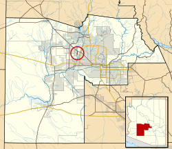
 Location in Maricopa County and the state of Arizona |
||
| Location in the United States | ||
| Coordinates: 33°35′41″N 112°17′56″W / 33.59472°N 112.29889°WCoordinates: 33°35′41″N 112°17′56″W / 33.59472°N 112.29889°W | ||
| Country | United States | |
| State | Arizona | |
| County | Maricopa | |
| Government | ||
| • Mayor | Michael LeVault | |
| Area | ||
| • Total | 1.3 sq mi (3.4 km2) | |
| • Land | 1.3 sq mi (3.4 km2) | |
| • Water | 0.0 sq mi (0.0 km2) | |
| Elevation | 1,138 ft (347 m) | |
| Population (2010) | ||
| • Total | 6,156 | |
| • Estimate (2015) | 6,613 | |
| • Density | 3,093.08/sq mi (1,182.64/km2) | |
| Time zone | MST (no DST) (UTC-7) | |
| ZIP code | 85363 | |
| Area code(s) | 623 | |
| FIPS code | 04-85400 | |
| Website | Town of Youngtown, Arizona | |
Youngtown is a town in Maricopa County, Arizona, United States. According to the 2010 census, the population of the town is 6,156. Youngtown is the oldest retirement community in the U.S.
In 1954, two developers bought 320 acres (1.3 km2) of farmland and built the first master-planned, adult community in the United States, dedicated exclusively to retirees. Designed by Ben Schleifer, the community was ironically named Youngtown. In 1996, the town, citing its age restrictions, denied extending the stay of a 16-year-old child to live in the community. In response, Arizona Attorney General Grant Woods investigated and determined that the age ordinance was unenforceable. In response, Youngtown repealed the age restrictions in 1999.
Youngtown is located at 33°35′41″N 112°17′56″W / 33.59472°N 112.29889°W (33.594603, -112.298776), on the east bank of the Agua Fria River, just south of US 60, & bordered on the west by El Mirage, Arizona & on the east by the much larger retirement community of Sun City, Arizona.
According to the United States Census Bureau, the town has a total area of 1.3 square miles (3.4 km2), all of it land.
As of the census of 2000, there were 3,010 people, 1,641 households, and 746 families residing in the town. The population density was 2,296.1 people per square mile (887.2/km²). There were 1,783 housing units at an average density of 1,360.1 per square mile (525.5/km²). The racial makeup of the town was 88.90% White, 1.36% Black or African American, 0.50% Native American, 0.60% Asian, 0.27% Pacific Islander, 7.24% from other races, and 1.13% from two or more races. 12.72% of the population were Hispanic or Latino of any race.
...
Wikipedia


